
Sattva Uttari is at Uttari, a village in the Bangalore South taluk of Bengaluru, about 2.4 km west of Kaggalipura and about 3.3 km by road from Kanakapura Road. The PIN code is 560082. Uttari sits in the green pocket between two of South Bengaluru's corridors: Kanakapura Road to the east, with the Green Line metro ending at Silk Institute about 8.5 km away, and Mysore Road to the north-west, reached at Kengeri about 15 km away. Within about 6.5 km are six schools and colleges, the Art of Living International Center and two lakes. Sattva Varthur Road is useful for the same-city location lens because the real test is weekday travel, school runs, healthcare access, and how the approach road feels at peak hours.
The exact site of Sattva Uttari within the village has not been published yet. Every distance on this page is by road from the centre of Uttari village, rounded, and the off-peak driving times assume light traffic. Your own gate-to-desk time will depend on where the site entrance falls and on the hour you travel.
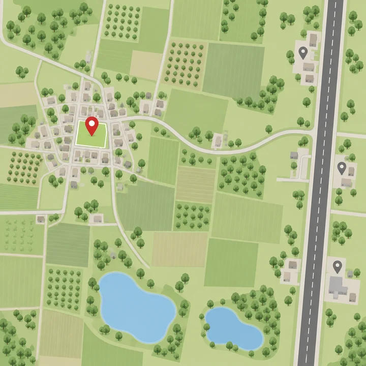
Uttari Village, Kanakapura Road
The village
Uttari is a small village of orchards and farmland, with the first new housing projects starting around it. Its nearest neighbours by road are Banjarapalya (about 2.6 km), Kaggalipura (about 3 km), Agara (about 4.3 km) and Udayapura (about 4.8 km), the village beside the Art of Living campus. Somanahalli, with its engineering college, is about 7 km away. The village lies to the west of Kanakapura Road, so it is set back from the highway's traffic rather than fronting it.
Sattva Uttari's site is within this village. It is a separate project from the other Sattva projects in the corridor, which are on their own land near Kaggalipura and the Art of Living.
Uttari village PIN code 560082
Uttari shares PIN code 560082 with Kaggalipura, Thataguni, Udayapura, Somanahalli, Taralu and other villages of Bangalore South. The full postal address of Sattva Uttari, with its survey numbers, is published with the K-RERA registration.
Two corridors, one address
Most homes on Kanakapura Road face one way: north up the highway to the metro, Banashankari and the city. Uttari has a second direction. Its village roads run west and north towards Kumbalagodu, Kengeri and Mysore Road, so the Kengeri side, with the Purple Line, the Bengaluru–Mysuru Expressway and the Kumbalagodu and Bidadi industrial areas, is within about 11 to 15 km as well. For a household with one person working along Kanakapura Road or in JP Nagar and another on Mysore Road or in Bidadi, that is a rare middle ground.
Sattva Uttari Distances at a Glance
| Destination | By road | Off-peak drive |
|---|---|---|
| Kanakapura Road at Kaggalipura | about 3.3 km | about 6 min |
| Kaggalipura | about 3 km | about 6 min |
| Udayapura | about 4.8 km | about 8 min |
| The Art of Living International Center | about 5.4 km | about 8 min |
| NICE Road, Kanakapura Road interchange | about 8.2 km | about 12 min |
| Silk Institute metro station (Green Line) | about 8.5 km | about 12 min |
| Thalaghattapura metro station | about 10.2 km | about 13 min |
| Kumbalagodu Industrial Area | about 11 km | about 15 min |
| Challaghatta metro station (Purple Line) | about 13.6 km | about 18 min |
| Kengeri Satellite Town | about 14 km | about 20 min |
| Bidadi Industrial Area | about 15 km | about 25 min |
| Kengeri metro station | about 15.4 km | about 20 min |
| JP Nagar | about 16.6 km | about 18 min |
| Banashankari | about 17 km | about 19 min |
| Jayanagar 4th Block | about 19 km | about 20 min |
| Silk Board junction | about 22.6 km | about 25 min |
| Majestic and KSR Bengaluru City station | about 25 km | about 28 min |
| MG Road | about 26 km | about 29 min |
| Electronic City Phase 1 | about 27 km | about 28 min |
| Kempegowda International Airport | about 58 km | about 62 min |
These are free-flow times. At peak hours on Kanakapura Road and the Outer Ring Road, plan for well over double.
Sattva Uttari Metro and Rail Connectivity
Green Line at Silk Institute
The nearest metro station is Silk Institute, the southern end of Namma Metro's Green Line, about 8.5 km by road. Thalaghattapura, one stop north, is about 10.2 km away, and Vajarahalli about 11.5 km. The Green Line runs north through Konanakunte Cross, Yelachenahalli, Jayanagar and Majestic, so a resident can drive or ride to Silk Institute and reach the city centre by train. Silk Institute is also the last metro station on Kanakapura Road today.
Purple Line at Challaghatta and Kengeri
The Purple Line's western end, Challaghatta, is about 13.6 km by road, and Kengeri and Kengeri Bus Terminal stations are about 15.4 km away. The Purple Line serves Mysore Road, Majestic, MG Road and Whitefield, which makes it the better line for east Bengaluru offices.
Suburban and long-distance rail
Kengeri railway station is about 15 km away and Hejjala station about 16 km, both on the Bengaluru–Mysuru line. KSR Bengaluru City station, for long-distance trains, is about 25 km away.
Honest note
There is no metro station within walking distance of Uttari, and none closer than Silk Institute today. A car, a two-wheeler or a feeder ride to the station is part of daily life here.
Sattva Uttari Road Connectivity
Kanakapura Road (NH948). The highway is about 3.3 km away at Kaggalipura. North, it runs past the Art of Living, Thataguni and Thalaghattapura to the NICE Road interchange, Konanakunte, JP Nagar and Banashankari. South, it leads to Harohalli and Kanakapura town, about 36 km away.
NICE Road. The NICE Peripheral Ring Road can be joined at its Kanakapura Road interchange, about 8.2 km away, and at the Sompura ramps about 10 km away. From there it runs east to Bannerghatta Road and Hosur Road at Electronic City, and north-west to Mysore Road and Tumakuru Road, bypassing the city's inner traffic.
Mysore Road and the expressway. Mysore Road can be reached at Kengeri, about 15 km away, where the Bengaluru–Mysuru Expressway also begins. Mysuru is about 137 km away by road.
The airport. Kempegowda International Airport is about 58 km away, around an hour off-peak by NICE Road or through the city. It is the longest of the regular trips from Uttari.
Sattva Uttari Schools
| School | By road |
|---|---|
| Edify School | about 5 km |
| The Valley School | about 5.5 km |
| Jnana Sweekar Public School | about 9 km |
| Deeksha (Kanakapura Road campuses) | about 9 to 10 km |
| Chinmaya Vidyalaya, Banashankari | about 10 km |
| Ekya School, Kanakapura Road | about 12 km |
| Siddaganga National School | about 12 km |
| Vidyashilp, Banashankari | about 12.7 km |
| Sri Kumaran Children's Home | about 14 km |
| Ryan International School | about 14.4 km |
The Valley School, on its wooded campus at Thataguni, is the best known of the schools near Uttari. Families wanting a city-side CBSE or ICSE school will find most of the choice 10 to 15 km north, along Kanakapura Road and in Banashankari.
Sattva Uttari Colleges
Uttari's distinctive neighbour is a belt of colleges within about 7 km:
| College | By road |
|---|---|
| APS College of Engineering, Somanahalli | about 4.9 km |
| Dayananda Sagar Academy of Technology and Management, Udayapura | about 5.7 km |
| Jyothy Institute of Technology, Thataguni | about 6.1 km |
| Indus Business Academy | about 6.3 km |
| KS Institute of Technology | about 11.3 km |
| RV College of Architecture | about 11.8 km |
| KS School of Engineering and Management | about 12.5 km |
| Christ University, Kengeri campus | about 13 to 14 km |
| Rajarajeswari Medical College | about 14 km |
For a family with a child entering engineering or management college, that is a short daily drive rather than a hostel. The same belt supports steady rental demand from faculty and staff.
Sattva Uttari Hospitals
| Hospital | By road |
|---|---|
| Kaggalipura Government Hospital | about 3.5 km |
| St. John's Health Centre | about 3.5 km |
| Sri Sri Ayurveda Hospital | about 6.1 km |
| Zymus Hospitals, Kanakapura Road | about 11 km |
| Aikya Healthcare, Kanakapura Road | about 11.6 km |
| Cloudnine Hospital, Kanakapura Road | about 12.2 km |
| Rajarajeswari Medical College and Hospital, Mysore Road | about 14 km |
| BGS Gleneagles Hospital, Kengeri | about 15.6 km |
Primary care is close, at Kaggalipura. For multi-speciality and emergency care, the nearest choices are 11 to 16 km away, on Kanakapura Road towards Thalaghattapura and on the Kengeri side. Note both routes before you need them.
Sattva Uttari Offices and Employment
Uttari draws on three job areas rather than one:
- Kanakapura Road and South Bengaluru. JP Nagar's offices and industrial area (about 19 km), Banashankari and Jayanagar (17 to 19 km) and the services along the highway.
- The Mysore Road industrial belt. Kumbalagodu Industrial Area (about 11 km) and Bidadi Industrial Area, with Toyota Kirloskar's plant (about 15 km). Sattva's own Sattva Global City office campus on Mysore Road is about 16 km away.
- The tech corridors. Electronic City is about 27 km away by NICE Road, and Silk Board about 22.6 km. These are longer daily drives, better suited to hybrid work.
The Harohalli industrial area of KIADB, further down Kanakapura Road, is about 21 km away.
Sattva Uttari Shopping and Daily Needs
Daily shopping near the village is small and local, at Kaggalipura and along Kanakapura Road. The larger stores begin about 11 km north: DMart on Kanakapura Road (about 11 km), then Forum South Bengaluru (about 13.8 km), Royal Meenakshi Mall (about 18.4 km) and Nexus Vega City (about 19.5 km) on Bannerghatta Road. The planned convenience store within the community helps with the everyday top-up.
Green Space Around Uttari
Uttari is surrounded by orchards and farmland rather than built-up blocks. Agara Lake (about 5.9 km), Thataguni's Agara lake (about 6.2 km) and Kuppareddi Kere (about 7.5 km) are the nearest water bodies, and the Art of Living campus, with its own gardens and hill, is about 5.4 km away, which makes Sattva Uttari one of the newer apartment projects near the Art of Living ashram. The air is noticeably cleaner and the nights quieter than in the city, which is the reason many buyers come this far south.
Sattva Uttari Location Trade-offs
- Distance from the core. MG Road is about 26 km away and the airport about 58 km. This is a location for people whose work and schools are in South and South-West Bengaluru.
- Metro by car. The nearest station is about 8.5 km away. Until a closer station is built, plan on a drive or feeder ride.
- Village roads. The last 3 km from Kanakapura Road are on village roads. Check their width and condition on a site visit, and ask Sattva how the project's approach road will be built.
- Retail and hospitals. Large stores and multi-speciality hospitals are 11 km or more away.
- A developing area. New projects are being built around Kaggalipura. Expect construction traffic for some years, and ask how the land around the site is zoned.
Is Uttari a Good Place to Buy
Uttari suits buyers who want the green belt south of the city, a larger home for the money than inner South Bengaluru offers, and access to both Kanakapura Road and the Kengeri side. Sattva Group already builds in the same corridor, at Sattva Springs in Kaggalipura and Sattva Forest Ridge in Anjanapura, so buyers can see the developer's work nearby before deciding. The questions to settle are the site's exact position and approach road, the K-RERA registration and the delivery date, all of which are announced with the launch.
Visit Sattva Uttari
To plan a visit, take Kanakapura Road south past the NICE Road interchange and Thalaghattapura, continue past the Art of Living at Udayapura towards Kaggalipura, and turn west on the village road to Uttari. Use the contact page to get the site location as soon as it is released and to book a visit.
Sattva Uttari Location FAQs
How far is Sattva Uttari from Kanakapura Road?
About 3.3 km by road from the centre of Uttari village to Kanakapura Road at Kaggalipura, roughly six minutes in light traffic. The exact distance from the project gate is known once the site is published.
How far is the airport from Sattva Uttari?
Kempegowda International Airport is about 58 km by road, roughly an hour in light traffic by NICE Road or through the city, and much longer at peak hours.
Are there good schools near Uttari?
Edify School is about 5 km away and The Valley School about 5.5 km. Most other well-known schools, including Ekya, Chinmaya Vidyalaya, Vidyashilp and Sri Kumaran Children's Home, are 10 to 14 km north along Kanakapura Road and in Banashankari.
Which is the last metro station on Kanakapura Road?
Silk Institute, the southern end of the Green Line, about 8.5 km by road from Uttari. Thalaghattapura, one stop north, is about 10.2 km away. There is no station closer to Uttari today.
Can I reach Mysore Road and Kengeri from Sattva Uttari?
Yes. Kengeri on Mysore Road is about 15 km away by road, with the Purple Line's Kengeri station about 15.4 km and Challaghatta about 13.6 km. The Kumbalagodu industrial area is about 11 km away on the same side.